running & cycling

Tuesday, October 23, 2007

October 5-6, 2007
Pitchell 110K Fun Run

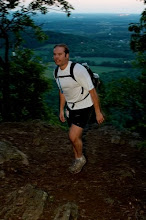
Last year’s Pitchell run had marked a new high for me in both distance and time on my feet. I hadn’t run more than 41 miles previously. This year, I had the advantage of having run a greater distance several times this year. That is also a liability as it’s easy to think you can always do something you’d done before. Last year, I didn’t really know what to expect but this year two sections really stood out as being formidable, Lane Pinnacle and Blackstock Knob.

The list for running Pitchell stood at 13, but dwindled to 9, and then 7, by race day. We met at Adam Hill’s house for pizza and a prerace briefing. After dropping vehicles at the Folk Art Center, we headed up toward Mt. Pisgah, one car dropping aid along the way.

Last year, we nearly froze waiting for midnight atop Pisgah. This year, a few of us planned on starting a bit earlier. I hiked to the summit with Mohammed Idlibi and India Coleman. We left the summit at 10:25, gingerly hiking down the wet, rocky Pisgah trail. When we arrived at the parking lot, the rest of the crew was ready to summit. Adam Hill, two time finisher, Kevin Lane, who started last year, Charlie Roberts and Stu Gibeau headed up the Pisgah trail while we hit the Shut-in.

The first climb is very steep and I let them go ahead, knowing I’d catch them on the downhill. This is the last stretch on the famous Shut-in Ridge trail run.

Descending it at night is rather precarious. A few spots have precipitous drops and the wetness added to the danger.

It didn’t take long before we had our first bear encounter. Mo was in front and the bear was right on the trail. It took off and ran up to the left of us into some brush. We soon made it to 151, where Sarah Almodovar was waiting with an aid car. Matt Kirk was also there, slowly driving my car back from Pisgah, along with Uwharrie, who had both hiked most of the AT already this year.

Refueled, we continued. I set a relaxed pace. Mohammed was holding back a bit since he likes to start out pretty fast. India and I pace very well together. We crossed the Parkway several times and had another bear encounter.

The climb up Ferrin Knob was difficult, made more so by rollerblading on the numerous acorns. On the way down, yet another bear was on the trail. It took off to the right. I searched for it with my headlamp and saw its eyes. The last thing you’re supposed to do is to stare down a bear, but with the light on him, he just froze.

A noise followed us in the form of Charlie. He had left an hour later but caught us just ten miles in. He flew past us and we met up with Sarah again at Bent Creek Gap. Just as we arrived, Kevin came in as well. Mohammed took off ahead of us and Adam came in just as we were leaving. Kevin went ahead and Adam soon caught us and stayed with us for a while. He then took off to catch Mohammed.

India and I plodded along, continuing to take our time. It would have been nice to break last year’s time but I wasn’t nearly rested enough to even give it a try. India just wanted to finish and become the first woman to do so.

After a couple more miles, Stu caught up as well. I felt for him being in the back by himself as I was for the entire run last year.

We met Sarah again at the Hardtimes trail. The yellow, crescent moon rose through the trees. India taped her feet and we were on our way down to the river. I stopped along the way and set my pack down, apparently in some poison ivy since I broke out a few days later.

The Asheville section is quite forgiving but we still took it easy. Sarah met us for the last time at the I-26 bridge. We got in more running but were still behind our expected pace. We took the Parkway briefly to save a few minutes and jumped back on the trail to hit the Folk Art Center, where the 50k runners started and where Matt was waiting for us with much appreciated sustenance.

This is the point where the climbing really begins. It’s mostly upward all the way to Rich Knob. I struggled on the climb and lingered behind a bit. After a few quick rest stops, we made it over the top and then enjoyed smooth sailing for a good while. The rest of the section contained gentle climbs and descents with a fair amount of relatively flat terrain, where I finally got my groove on with some bursts of speed.

The guardrail at Craven Gap provided an outstanding spot to lie down and relax our entire bodies. As the miles wear on, the desire to sit and to lie becomes rather obsessive. The next short section is one of my favorites.

This rocky stretch features a gradual climb with some short dips and rock gardens. We were met half way through by Mike Jackson, who had helped plan the original Pitchell run with Adam, but was unable to run it due to injury. At the aid station, Matt Johnson was waiting for us. He had run a portion of the first Pitchell and continued from that point on the second running to cover the entire course. A nagging ailment prevented him from trying the entire run this year so he assumed the role of support.

The next eight miles would be a serious test. Last year, it took me over three hours to run it. It starts out with a relatively easy bit and then climbs gradually toward the site of the old Rattlesnake Lodge. We saw more than a dozen hikers at the site. There's a half mile trail leading up from the Parkway to the site.

From Rattlesnake Lodge on there is nothing but climbing. It's not all steep but it increases in grade as it ascends. It also becomes very rocky. We stopped a few times to rest and get off our feet.

The trail goes through a gap and then ascends sharply to the left. This is the area that can break a runner trying to complete the task. It's here where you can question why you're even bothering to do this. Last year, I'd had the luxury of ignorance in not having any idea when the madness would stop. I always remember the difficult spots but I'm always a good bit off on remembering the true distances of such spots. I thought we only had to traverse several small peaks before Lane Pinnacle stared us down. It was closer to a dozen.

These peaks weren't all that tall but they were steep and arms were required to help pull tired bodies up their faces. On one of them, a large bird landed about eight feet in front of me at about eye level. At first, it appeared to be a hawk, but the markings weren't quite rifgt. It was more grey than brown with a white pattern. Unfortunately, I said something and scared the Peregrine Falcon and off it went. The falcon taking off was quite a sight. Neither of us had ever seen a falcon up close in the wild before.

The trail wore on over more peaks until Lane was finally within sight. I saw it early on but thought there was no way it was that far off so I dismissed it as a peak we would have to climb. Lane is steep and even has a ladder built over a portion of its rock face. Above the ladder is one of the finest lookouts to be found. I'm sure everyone stops here for a spell and we were no different.

The downhill is a slow go. There's a fair amount of boulder hopping, something that has to be expected on the last twenty miles of Pitchell. The downhilling got a bit easier but the trail likes to fool you as you think you're about to pop out on the Parkway but then it turns you left through a sea of green bushes. Here, we took stock of food and ate most everything. Traveling at a slower pace, much more solid food is necessary. We were both famished and looking forward to the aid station.

We ran across a grass field next to the Parkway. Last year, I'd been upset because I thought this was where the aid would be. It was still a mile further. We headed back into the woods for another climb. It started raining lightly. When the trail turned to the right, I knew we were about there.

Todd and Gary greeted us with coolers full of food. We tore into some pizza and other assorted goodies. We were told that we looked much better and were in better spirits than anyone else. The clock was ticking and it was evident that there was no way to make it to Mitchell before dark.

After leaving the aid stop, we made our way to the Craggy picnic area and just then, it started raining again. It came down much harder this time, but fortunately, we had shelter from it so we avoided getting soaked.

It's a steep climb up to the CCC shelter on the trail. Beyond it, the trail gets extremely rocky. The trail actually becomes a series of boulders with no dirt whatsoever. India slowed down a bit. She was feeling the overall body punishment that Pitchell wields to anyone who dares to conquer it. I thought she might want to drop at the next stop. She wanted to make it through but it's one of those endeavors where there is no guarantee. Simply finishing is an incredible accomplishment, no matter how long it takes.

We slowed our pace further and she wasn't feeling well. A couple of stops helped but I still figured she was through. I would have to decide whether to continue by myself or drop as well. Considering there wasn't much time before nightfall, I came to the conclusion that I would drop as well, despite having plenty of energy.

Adam and Stu were at the aid station. They'd dropped after 55 miles and expected us to do so as well. Fortunately, as we rolled in, India said she wanted to continue. Although I would be okay wityh stopping, I really wanted to continue as well. We just had to work out an automobile scenario because nobody would be able to wait until 10:00 or whenever we would finish. Adam and Jon Snow set up two food drops and brought India's truck near the finish.

We set out again and I came up with an idea which would allow us to finish safely. A 5 1/2 mile stretch involved a ridiculous amount of boulder hopping in a very dark and remote forest. The boulders would be wet and it would be completely dark by the time we hit them. There is a rocky, gravel road which skirts the mountain range and leads to the entrance to Mt. Mitchell state park. Deciding to take the road eased my worries. There would be no one to search for us if one of us had gotten hurt. I really banged up my knee on a boulder there last year and it was plenty dry and bright.

After leaving Adam and Stu, we entered a gorgeous section replete with blueberry bushes and long range views. We took our time and soaked in the vast panorama laid out before our eyes.

A succesion of small mountain climbs led us to Balsam Gap. This is where both the gravel road and the ridiculously difficult boulder section begin. Adam left a well stocked cooler for us. I took off my shoes and socks to massage my feet. We saw Adam drive by to drop off the truck. I ran out to the Parkway in bare feet and waved my arms and he saw me in the rear view mirror. I confirmed that the gravel road did indeed come out where I thought it would and he picked up the cooler.

We forged our way down the road but stopped when we saw a truck parked in front of us and a man approaching from the rear. We ignorantly asked if it was okay to use this road since it went through private property. Signs clearly state "no trespassing". They only applied to the land along the road. The man, who is a landowner, stated that the road was open to the public. We talked for a while and said we'd just come from Pisgah. He looked at us incredulously, realizing that 6 more miles of trail wouldn't be an issue for us, even in the dark.

We didn't do much running. After all of the hiking required to reach that point, it was difficult to get the legs moving quickly again. We stopped a couple of times and wondered if the road would ever end. Some of it was overgrown, some very wet and some quite rocky. It hadn't seen vehicular traffic in some time.

After two hours, we finally made it to pavement! We searched for the truck but it was nowhere to be found. I'd expected it to be just outside the gate but all we saw was one passenger car. It was almost ten o'clock. We opted to find the truck first and then summit Mitchell. Just then, someone approached with a flashlight. It was a camper who'd shown up too late to secure a spot in the campground. He offered to take us down to the Parkway, where he'd seen a truck with a logo on its side.

On the way down, a young coyote ran across the road. We drove the truck back up to the gate and got ready to summit. Then, flashing lights came toward us. It was the feds and we thought they were after us for parking in a no parking zone. It turned out that they were searching for some lost hikers and wanted to know if we'd come across them. They may have been on the section we circumnavigated.

The trail can get to you after a while, as can aches and pains. We could have taken the Old Mitchell trail like we'd planned but opted for the road instead. It was a little longer on the road but much, much easier.

We made it to the parking lot and the elevation sign, lay down for a minute and then headed back down. The summit is still closed due to construction of a new observation tower. We hiked the road with our lights off to observe the starry sky. It grew quiet for a while but then we were startled by what sounded like several deer running on the pavement. Switching on our lights, we couldn't tell what had just happened. I scanned a cliff above the road and saw what looked like six sets of eyes. Eventually, I could make out the outline of a rather large bear.
The other sets of eyes could have been other bears but it wasn't possible to positively identify them. The noise was claws scrambling up a sheer rock face. Perhaps, there were six bears but I've never seen more than three together before.

We finally made it back to the truck and headed back toward town. The trek took about 24 hours. On the way back, There was a heavy rescue truck and several other vehicles mobilizing to search for those lost hikers we'd heard about. The ride down the Parkway took a couple of hours since we were both falling asleep and had to pull over for a few quick cat naps.

This year saw five finishers. India Coleman became the first woman to make it through. Muhammed Idlibi, Charlie Roberts and Kevin Lane all became first time finishers and I completed my second Pitchell journey. Kevin set a course record with an astounding time of 15:18. Thanks to all of the volunteers, including Jason Hayward and Jon Snow, both of whom we didn't get to see but who were manning aid stations.

B-Rex

Friday, October 12, 2007

September 29, 2007
Great Eastern Endurance Race 100k & 50k

My body didn’t respond well last week so I was glad to be a sweep on this adventure. I would follow the last runner to make sure everybody made it to each checkpoint safely and clean up course markings along the way. I’d also close off certain trails which wouldn’t be used again in the race. On the last two stretches, I would hang chem. Lights for 100k runners.

I stayed on location Friday night along with a guy named Marty. He would be running the primary aid station and get the finish line organized. Being on site meant there was no rush in the morning but I would be sleeping in my car.

I let everybody go ahead of me and looked around for late starters. The run started on the road but quickly turned onto a singletrack trail. This trail climbed rapidly. I caught up to the last runners and warned them of my presence but I also informed them that I wasn’t enforcing cutoffs and found it acceptable to finish in twelve hours. One woman approached from behind. She had made a pit stop and then briefly got on the wrong trail. I’d already taken down some streamers and flags.

At the top of the steep climb, the trail turned and it was well marked. It took several minutes to clear off all of the trail markings. This allowed the slower runners to put some space between them and me. I was now on a ridgeline, enjoying the sunrise. Several overlooks afforded views of the area.

I took my time but still caught up again. Fortunately, there was a trail to close off which ate up some time. Getting the flags to penetrate the extremely dry dirt was quite a chore. When I made it to camp Marty, the first aid station, one guy was still there but my presence made him move a bit quicker. The next section was all trail, very enjoyable and more moderate in elevation change.

I took my time at the next aid station and then took off along the Blue Ridge Parkway. The lead runners were already coming at me, nearly 14 miles ahead at that point. I cheered them all on as I passed them. Having an extended out and back section meant that you got to see everybody else. I passed many familiar faces and chatted with a few runners. I saw Sarah Almodovar, Marc Castleberry, who had been awakened by a bear while napping on the Table Rock Run, John Straub, Dave Snipes, Bedford Boyce, and a bit later, Debbee Straub.

After a good while on the Parkway, I took a gravel road. This went on for about four miles downhill. The course then headed back up that same road for a gain of over 1500 feet. The last runner chatted with me for a while and then went on his way. I assured him that he was doing alright on time and that I wouldn’t pressure him at his current pace.

Again on trail, I cleared off course markings and closed off another trail. I headed back to camp Marty, where I met up with the 100k sweep, also named Brian. I did my fastest running of the day for the next mile. I hit the next turn around spot well before three. I didn’t want to start hanging chem lights until 4:00, so I grabbed a chair and just looked out onto the view from one the highest points on the run. I headed out at three, figuring the lights would last long enough, which they did.

I didn’t have to worry about any 50k runners since they were well ahead at that point. I passed through camp Marty again. About a mile past the station, I heard some noise to the left of the trail. It sounded like a squirrel so I didn’t pay much attention. The animal then walked onto the trail. It was a large cat! I’d never seen a bobcat or a mountain lion in the wild before. Although it was 4:30, it was difficult to make out any markings. I only saw it for a few seconds. It seemed a bit dark for a bobcat but had to have been between 30 and 35 pounds, the perfect size for an adult bobcat.

There was a steep downhill and then a nice, easy section. I made it through the downhill just fine and then ran into complications on the easy bit. I don’t fall often, but when I do, it’s typically on an easy stretch following a difficult one. I was hiking and had just started to run and I clipped a short stump. I tumbled forward, trying to stay on my feet but my momentum was too great and I hit the dirt on my hands and one knee, and then continued to roll over my hands and hit my chin on the dirt. I cursed a few times and got back on my feet.

I was running out of chem. lights and still had some trail left. I’d rationed them fairly well but ran out before the end. The trail gave way to a grassy dam crossing and then a road to the finish. The first 100k runners arrived shortly after I finished.

September 22, 2007
Haw Ridge 54k

In my infinite wisdom, I opted for a night of drinking before the race. This turned into a much longer night than was planned. Midnight rolled around and it was time to stop drinking and sober up. I wasn’t in bad shape, but it was time to quit. I still hung out for a while and headed home at 2am. By 3am, I was out the door and on my way to Tennessee. The drive was difficult on no sleep, but I arrived ready to run.

Haw Ridge is a peninsula near Oak Ridge. It consists of some modest climbing and a fair deal of running along the lakeshore. It’s a four loop course and it’s nearly impossible to make a wrong turn.

I started out strong but slowed down near the top of the first climb. Some runners were only doing one or two loops, so they were going far too quickly for me. My body was tired from the Bridge to Bridge ride six days prior to this race.

The course was nearly all singletrack. The lay of the land was well suited to me but I couldn’t perform as well as I would have like to due to all over body fatigue. The first lap saw me come in near the back and I didn’t improve on the second one. Embarrassingly, I was lapped by two runners before I completed two laps. I knew it would be a long day.

The temperature rose rapidly and I slowed accordingly. On the third lap, I saw a man with trekking poles. I thought that a walker had caught up to me. My anxiety was eased after I talked to the man for a while. He was Leonard Martin, who had run Massanutten, Hard Rock and Barkley many times. He just ran Wasatch two weeks prior and rode the Bridge to Bridge one week ago. We were both moving slowly, but we were both beat down from so many endurance events. My anxiety faded and I became content with the idea of just finishing, no matter what the time or placing.

As I came through, I said goodbye to Chris Kaylor, who put me up at Burning River. He and Amy Bly were heading up to Ohio after the race. Amy had paced me at both Mohican and Burning River. She finished this race seventh overall, and was the first female finisher, on only her second ultra race.

I continued to struggle with the heat. I was only ahead of one runner at this point. He would drop out so I had to catch the guy ahead of me to avoid finishing last. I knew he would walk the entire course so I wasn’t too concerned. I caught him about a mile in and stayed with him for a moment before heading on. I finished second to last but it was still an accomplishment since I’d pushed my body so hard the previous weekend. I knew all of this racing would eventually catch up to me as well as the lack of sleep the night before.

Friday, October 05, 2007

September 16, 2007
Bridge to Bridge Incredible Challenge 100 mile ride

The Bridge to Bridge Incredible Challenge is among the most difficult century rides in the region. After traveling around on rolling hills, riders are confronted with a 13 mile climb up to the Blue Ridge Parkway on route 181. Then, after a spectacular ride on the Parkway, crossing the Linn Cove Viaduct, it continues to entrance to Grandfather Mountain. This is where the real fun begins.

This was my fourth time doing this ride but the first century ride of the year. The start had been moved back two hours but the cutoff time for riding Grandfather was kept the same. As a bonus, the course had an additional 1,000 feet of climbing. This brought the total climb to 10,500 feet.

The 800 rider mass start electrifies the spectators. It’s a wonderful sight seeing hundreds of riders in multicolored jerseys filling up the road as far as the eye can see.

The first 51 miles flew by quickly in 3 hours flat. The hills aren’t bad but they’re large enough to get you ready for the real climbing in the second half of the ride. This year’s cool weather provided optimal climbing temperatures and the climb up route 181 seemed much easier than usual. The sun didn’t beat down as fiercely as it had in the past.

Riding along the Parkway, I heard deafening screams of anguish. A rider was unleashing tormented cries due to severe cramping. Another one stopped along the road, trying to dismount, but wasn’t able to due to cramps so he just had to fall onto the grass with his bike toppling over him. Despite the ideal temps, there was still a fair share of muscle cramps.

Making the 7½ hour cutoff was a challenge and I came in with just a minute and a half to spare. Like I said, this is where the real fun begins. It can actually take longer to ride the last two miles than to walk it. Another rider started walking up while I rode and I didn’t pass him until the very top. Grandfather climbs 1,200 feet over its two mile ascent for an average grade of 13%, topping out at a whopping 24%. After riding 100 miles, doing a climb like that is no easy task.

A cramp strangled my right leg on the first steep switchback. I was forced to rest for several minutes and tried not to push too hard on the pedals the rest of the way. In the last half mile, a rider couldn’t pedal any more and simply feel onto his side, the sound of metal hitting pavement permeating the air.

The last switchback is one of the toughest and there’s an audience to watch you. I caught the guy who walked up with a last second burst of speed, which garnered some applause for the effort.

I still had some daylight left, so after retrieving my bike below Grandfather, I took off for Lenoir. The ride down 181 is unbelievably satisfying. It's 13 miles of nearly continuous downhill. Unfortunately, daylight was getting rare. I had a light but riding around blind curves at night is a bit dangerous. Fortunately, a pickup truck stopped and the driver offered me a ride back to my car. He had run support for the ride but only had to pick up one rider during the event.

I got 125 miles. That was by far the longest ride for me this year. Another Bridge to Bridge is in the books.

September 8, 2007
TR and More in 24
Table Rock to Montreat Trail Run

I hadn’t run in the Linville Gorge before. I’d hiked a portion of the route and recalled it was very difficult terrain even for just hiking. It would be a slow go much of the day, but a fantastic way to spend my birthday.

We met for a prerace meeting at Adam’s and then headed east to Black Mountain for burritos at Camino’s. The finish point was to be in Montreat, so we left vehicles there and carpooled to the gorge. The drive concluded with an endless journey through a veritable sandstorm of white dirt. The road was so dry from the drought that all of the vehicles became caked with dust. Rear windows were completely covered with over a quarter inch. Wipers had to be employed constantly. It looked like we had evacuated the site of a volcanic eruption.

We weren’t the only ones looking to camp in the area. The weather was fantastic and fortunately so, since we camped out under the stars. After getting situated on the solid rock atop Table Rock, we got to enjoy a couple of light shows. The fabled Brown Mountain lights made an appearance. These lights have been recorded for hundreds of years and appear as glowing balls of light often darting around and making their way up the mountain. Scientists still debate how they are formed, but they are most certainly not illusions or swamp gas.

One light flared brilliantly and was joined by another intermittently. They didn’t dance around for us but they did entertain and had us guessing if they were headlamps of hikers but they were way too bright for that. A couple of shooting stars lit up the sky as did the Milky Way. Getting away from the city lights, nebulae and the Andromeda galaxy were observable by the naked eye.

Drew brought up some Bud tallboys, which Adam and I enjoyed with him. Most of the others were nodding off but we stayed up a bit and observed the city lights in the distance. Soon it was time to go to sleep. The 5:00 wake up time wasn’t far off.

We made our way down the mountain and dropped off our sleeping gear. I led the pack up the trail briefly and then dropped back. Soon, all but one runner had gone ahead. India and I were in the back and we decided it was more important to pace ourselves than it was to stay with the others.

Running through the Chimneys is quite challenging. It was still a bit dark and the use of hands is required to negotiate the terrain. The trail is a bit deceiving. The area is a mecca for climbers and routes go off in all directions. The trail isn’t always marked at regular intervals. We came to a spot where the trail appeared to stop. We retreated, thinking we’d made a wrong turn, taking several of these climbing routes but none continued for long. Finally finding a course marking, we retraced the dead end trail to the spot where we turned back. It was a bit overgrown, but we had been on course the first time.

We had a long descent through some Carolina Hemlocks through rattlesnake territory. It was still early so no snakes showed themselves. The sun came up with a pink and then an orange hue.

Late spring saw a tremendous wildfire in the gorge. Entire trees had been scorched and the trail was nonexistent for good stretches. The fires had left a barren, almost lunar type landscape. Everything was blackened except for a small white coloration where the trail had been.

We continued to take it at an easy pace. We left the scorched area and entered a very rocky landscape. This was the trail type where small rocks were on top of other rocks, making it rather treacherous to run with any speed. The trail took a hard right, which would have been very easy to miss as another one continued straight. I headed down very quickly and waited for India at the bottom.

We soon found ourselves amongst more scorched earth. This time the trail was not apparent. Every bit of ground was blackened and all of the trees with markings were blackened as well. We had to search for footprints to find our way. A logging road was visible ahead so we took that down to the river. We heard voices coming from that direction. We got there and found Rob, who was searching for the trail. Having been forewarned about the confusing Linville River crossing, I knew it would be challenging to find the trail. We followed trail markings upstream but it seemed like a closed trail with numerous branches across it.

We chose the old trail and crossed where the markings ran out. The water wasn’t even knee deep. On the other side, no markings were present. It was bushwhacking time but we came across a dirt road in short order. It had markings so we followed it until a singletrack trail led off uphill. This was also marked but faintly so. It spilled onto a wide trail, which we followed downhill—the wrong way. Adam and Sarah came running up and we were all confused. They should have been way ahead of us but had waited where they crossed downstream.

We turned around and began a long, hot climb up to some peak. This was a steep go. We didn’t try to keep up with Adam, Sarah or Rob. The weather really started to heat up so we stopped occasionally to rest. The peak afforded nice views but we didn’t stay. Fluids were low and we needed to get to the aid stop. I downed two cokes and loaded my Camelbak with ice for the next leg.

We had some downhill for a good while and then climbed up to a dirt road. After a couple of miles, the road gave way to a steep trail. This was another slow climb to the top, where we could see the general area for the next aid stop. It appeared as though it was only 2-3 miles away, but it was much, much further.

The descent involved 40+ switchbacks. It was around 90 degrees at this point, so we even took it easy on the downhill to avoid overheating. Thankfully, there were several areas with large, shady boulders where we could cool off. When we reached a dirt road, I thought we were approaching the aid stop. I was considerably mistaken.

We hit another single track section, leading us to some train tracks. As we crossed them, I heard some noise and around the bend came a train. At this point, at least one runner had followed the tracks and had to ford the Catawba River. There was a new footbridge for the trail, which we utilized and then followed a dirt road. I misread a trail turn and took a different road. Realizing my mistake, I looked at the map and it appeared that we were on a shortcut so I opted to continue. After a while, we went through private land and back to the Catawba. It was time to backtrack, wasting time and fluids. We still had a long way to go until route 221.

Another singletrack stretch led up over what appeared to be a small hill but it kept going up. I ran out of fluid and had to bum off India. It felt as if heatstroke wasn’t far off. The sun relentlessly pounded us as we entered onto a dirt road. We followed this road down the hill, running through the sunny spots and taking our time in the shade. We finally popped out at 221, where we were greeted by Matthew and several others. We had a plan to get a ride to the next aid station so we wouldn’t be so far behind. Then we learned that two runners dropped and two others were only 30 minutes ahead of us. Everyone had planned to drop after getting to the Parkway.

We rested a good while before continuing. The 13 mile climb to the Parkway rose gently on an old road bed. It soon gave way to a very fast and smooth extended downhill. The stream at the bottom would be the last water we’d see for hours so we soaked a bit. We hopped on a grassy stretch of road bed until a sharp turn to the right, which we almost went past. This was an arduous climb, which leveled out occasionally but continued up for some time. It had cooled off slightly, but I faced overheating issues on the steep climb. We rested a few times here.

The trail continued on a mostly inclined plane until it took a sharp left. This was also easy to miss. The run was billed as an adventure run and it was. We followed trail markings but in some stretches they were absent. Turns weren’t always well marked and trail locations had been moved, not to mention the spots where the trail had been obliterated by fire.

I thought we only had a few more miles to go judging by time, but a quick look at the map showed we still had 6+ miles to go. Every section took substantially longer than expected. The heat had taken its toll. I questioned the accuracy of the published distances. The terrain was extremely difficult in places but it was broken up with some very runnable sections.

Continuing forward, daylight started to fade. Soon, we’d need headlamps. It was getting dark and we heard some rustling about 40 yards off the trail. There was a good chance it was a small bear. A little later, just after our headlamps were switched on, there was no question this time. A larger bear was just 20 yards to our right. It took off quickly. Shortly afterward, I missed stepping on a snake by about an inch. It slithered to the edge of the trail. In a moment of sheer genius, I stood over it to see what kind it was. There was no rattle but its head was viper shaped. It bore copper like markings on a grayish base. I didn’t expect to see a copperhead on top of a mountain but that’s what it was.

The remaining three miles would have to be traversed in the dark. I ran into a sharp stick but it didn’t do much damage. I let out a sharp cry but the pain soon went away. I ran out of fluid and just a couple of minutes later, I found a cold bottle of Gatorade in the middle of the trail. Jon Snow had placed it there for us and we were thankful for it.

The sound of automobiles gave us some hope that we were about through but it was all a tease. The trail skirted the parkway and then shot away from it. Soon, we did here a voice responding to our headlamps. It was Adam hootin’ and hollarin’ and we responded in kind. Everyone else had already stopped and gone home. I was feeling fantastic since it had cooled off. India was feeling all right as well. I would’ve continued if anyone else had but I also had no problem with calling it a day. It had taken 15+ hours to cover 39 miles of trail and with wrong turns, about 41. It felt more like 50. I still question the published distance.

I expended some excess energy by sprinting along the Parkway. Then we filled up on some food. As I sat down in the car, my inner thigh/hamstring broke out in some serious pain. I had to walk it off for some time. The full distance was nearly 60 miles and would make an outstanding run for a cooler day.

Thursday, October 04, 2007

August 25, 2007
Dupont Waterfall Bonanza

The second running of the Dupont 22 miler saw some new faces. Adam Hill had to miss out on the running again this year but his course was utilized by six intrepid souls, out to enjoy the rugged terrain of the Dupont State forest. I had to work at 6am that morning so the start time was pushed back a bit. We started at 10:30, and I quickly fell behind the bunch. Sarah, Beth, Charlie and Matthew went ahead. India waited for me, thinking she missed a turn. The entire group waited at the turn. We set out on a downhill, and I felt simultaneous stings on both calves. I let out a scream and kept running. The group went ahead again and India and I stayed together.

The first stream crossing had been over knee deep last year but didn’t come above the shins this year. India still managed to take a spill on her third or fourth step. The cool water soothed my yellow jacket stings.

I felt a burst of energy so I took off up the hill. I hadn’t done a hill sprint in some time so it was nice to push myself. It did take its toll on me and I needed a good bit of time to recover from it.

We came to the first waterfall which was Bridal Veil Falls. Sarah headed out to go to work. A short hike up a large slab of exposed granite led us to an overhang with a solid stream of water. I went behind it for a surreal view of the world. Others followed and then we all doused ourselves with the forceful spray. It was refreshing to say the least. Thoroughly soaked, our bodies were ready to push on.

India stayed a bit in front and I wasn’t able to catch up to her completely. I’d get within 30 yards and then she’d pull away. There was a good bit of gradual climbing but I struggled on it just like last year. The trails don’t appear to be that difficult at Dupont, but I always seem to have a hard time with them.

We all met up again before the long, rocky descent to the next waterfall. This was my kind of trail but I had some tendon issues and didn’t want to go full speed. At the bottom, we encountered a few horses. From there, it was a short hike to Wintergreen Falls. An older man and a young girl were there. They had a large, green parrot with them. The girl was dressed inappropriately to be with her father so they may have been an inappropriate couple. We didn’t ask and just took them for their entertainment value.

This water was much cooler so only Matthew and I got under the falls and I didn’t stay long. The pool below felt fantastic so we all got in for a swim. Thunder clapped in the distance so it was time to move on.

After about a mile, it began to rain and the skies just opened up. The thunder was right on top of us, banging loudly and causing shudders in our bodies. We were already soaked from the swim so it wasn’t a big deal but we did decide to skip a short side trail to the smallest waterfall. India and Beth went ahead while Matthew and I took it easy. Charlie stayed back with us as well. When we got to High Falls, there was no sign of the women. We figured they went on ahead.

After the heavy rains, we didn’t feel the need to spend much time at the waterfalls. Triple Falls was next and then we got back to the parking lot, still with no sign of the ladies. Hooker Falls was a quick out and back to finish off the tour. We saw Beth and India at the parking lot. They had made a wrong turn just after they went ahead but found their way back, covering about the same distance

August 18, 2007
Blue Ridge Brutal

I was invited up to West Jefferson to stay with a friend the night before the ride. I stayed with Annette Bednosky and her husband George. We had a fantastic time talking about running and enjoying a fantastic home cooked meal. I even got to watch a tape of the Western States 100 mile run, which focused on the Montrail team, of which Annette is a part.

I met Annette on this ride last year and have done many a run with her since. I’d planned on riding with her for much of the course but that didn’t work out so well. George went ahead and I tried to stay with my friend Bridgette, but she left me in the dust. Annette caught me but I couldn’t stay at her pace either. I could tell this would be a very long day.

My legs were far from recovered from the previous two weeks’ runs. When I told my thighs to push they just let out a feeble whimper and went back to lazing around. The struggle with my weary legs continued throughout the day. As I was riding along, I heard a clink. I’d broken a spoke. I was a bit upset, knowing that I’d likely break another one on the very difficult climb up Buffalo Mountain. I wasn’t really sure if I’d even be able to make it up that climb without any mechanical issues.

My stress was relieved when the decision was made to drop to the 70 mile option. I never like to give in but it was the right choice, considering the state of my body and of my wheel. This meant some waiting around and missing out on the Assault on Mt. Jefferson at the end of the ride. Bridgette and Annette both did the Assault. Next year, I’ll get in more miles on the bike to balance things out between running and riding.