running & cycling

Saturday, February 03, 2007

February 3, 2007
Thermal Belt Rail Trail Ultra

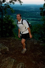
I looked at the thermometer-20 degrees, ouch! I was in no rush to hit the trail. Greenbrier will be a flat rail trail so I figured I should get in some time on the flat. The plan was either to run it once and ride it once or to run it twice. Since I didn't sign up for Uwharrie on time, I was hoping to get in my own ultra this day.

The drive to Rutherford County passed a number of clearcuts along the road. Many mountains had been stripped completely of their precious trees. Rutherford also boasts the highest unemployment rate in WNC, and the greatest number of meth lab busts in the state.

I arrived after 10:00, which was fine considering the chilly weather. A hawk greeted me as I got out of the car. I started in an urban section where the trail ran between two motor roads. Only a quarter mile in, I passed a homeless hangout consisting of two cinder blocks and a clear plastic lean-to. The trail ran through a sparsely populated neighborhood for a bit and then through an industrial sector. This area used to be replete with furniture and textile mills but most have been shut down and many have been demolished. Some mill towns have become ghost towns.

Further along, the trail finally got rural. I scared up a pair of vultures and would do so again on the repeat voyage. Yes, the suspense is over. I ran it twice. The views opened up a bit and distant mountains made their presence known. I had read that many pines had fallen across the trail. I saw only one and it obscured only half of the trail.

Since it ran near to many homes, I expected dogs to run out on the trail after me. I wasn't disappointed, they barked and growled but none came very close to me. I hit the turn around, which I thought was four miles but it took a full hour. How could it take an hour to go four, flat miles? It wasn't entirely flat but had very modest elevation changes. The supposed halfway point was actually 5 1/2 miles from that end, not 4.

The trail stopped at a sawmill. Apparently, they still use the rail line to the north, which is a shame because the scenery is far more compelling. It follows a stream and passes many hills and mountains. I snacked and headed back south. The same dogs had something to say to me again.
The return was otherwise uneventful and I reached the car at two hours.

South of the car, the winds actually picked up. There were more trees in the rural section to block the wind. The trail followed the road for a while and then veered off a bit along a wooded area. Garbage was strewn all around and several camps were apparent. Trails led into the woods every fifty yards or so. I named this the "Homeless Forest".

Beyond the Homeless Forest, An enormous, vacant mill filled my line of site. I wondered just how many people resided in the forest. I approached downtown Spindale and soon the rail trail became a grand boulevard. It again passed between two roads and was lined with trees on either side. I was pleasantly surprised to see that Barley's Taproom had just opened. I would park in Spindale the next time in order to take advantage.

The boulevard stopped when the tracks appeared. The section open is eight miles in length. I would try to cover the entire length four times. During the next trip through the forest, I saw a man walk from McDonald's across the trail and disappear into the wooded abyss. He vanished into the brush. McDonald's is 15 yards off the trail.

I got back to the car again and decided I was ready for 16 more miles. I jogged about two more miles and I couldn't continue jogging any further without walking a bit. I made it 18 miles without doing any walking at all, which was a new record for me. I hadn't run into any nonhomeless people until I came upon a typical couple walking their goats. I hadn't yet seen anyone walking their dog, riding a bike or running, but I ran into a couple walking their goats. They were being trained as pack goats and would be able to carry 60 pounds eventually.

On this return, I actually saw a runner. He was working harder than I was but I resigned myself to a much slower pace than the first round. The next time through the forest I didn't see anyone. This surprised me since it wasn't that long until darkness.

I had made it 32 miles. I wasn't sure I could do it this day because I'd been ramping up my mileage lately, and had spent two hours each of the previous two days lifting weights, including deep squats and leg extensions the day before. My quads had been hurting for hours, but I wanted to run tired and sore to prepare for the really long runs I have planned over the next several months.

Raging Bull

January 27, 2007
Seven Sisters Summit 50k

The morning was brisk but the forecast was promising. Five of us embarked on a journey through the challenging and occasionally insane singletrack of Montreat. Sarah Almodovar, Steve Parrish, Mike Piercy, Kevin Lane and I bundled up to fight the freezing temperatures. Our pace was slow but there was no need to hurry. After a brief warmup on the Gate trail, we ascended quickly on the Rainbow trail. At times, you have to use your hands to steady yourself on this trail. The grade tops 40% for two brief periods. The tough go got a bit easier at the summit of Rainbow mountain.

We continued to Lookout trail. This went up into a rocky crag. This wasn't a spot for running or hiking. It was all climbing until we hit the summit and were rewarded with the first spectacular view of the day. We looked down upon Montreat and were amazed at how far up we had climbed in such a short time. The temperature had increased a bit so we basked in the sunlight and took in much of the mountain ranges we would soon traverse.

The East Ridge trail follows the ridgeline for its entirety. It ascends several mountain peaks along the way. It's a steep go in some spots. Sarah and Kevin tended to get well ahead of us on the climbs. I always look forward to the downhills and hammering the descents is where I excel. On Rocky Head, we could see Table Rock and Hawksbill mountain in the Linville Gorge wilderness.

We took the Trestle trail to get to the Graybeard trail. Trestle was the path of the Mt. Mitchell train tracks and was used in part for the Mitchell Toll road for automobiles. This was where Sarah headed down to set up an aid spot for us. The rest of us headed up Graybeard trail. It's a slow go and passes a small waterfall. We ascended for quite some time until we came upon a shelter, which had much of its roof ripped off by high winds. A short side trail led to Walker Knob, and an unbelievable vista of Montreat, Black Mountain and beyond.

The trail continued steeply up Big Slaty and then on to Graybeard mountain. At 5408 feet, this would be the high altitude for the run. It is also one of my favorite views anywhere. We stared in awe for a while and headed back toward the Westridge trail.

Westridge is no more steep than Eastridge but it is extremely rocky. It's not just a little rocky. it's almost entirely run on rocks. This means any wrong step can lead to disaster. Kevin and I hammered it anyway. It was nice to be ahead for a good while. I'm usually trying just to stay in site of the runner in front of me. The Asheville watershed came into view. The reservoir looked bluer than I'd ever seen it.

After a good bit of downhilling, we came to Big Piney Ridge. We followed the trail to the Rattlesnake overlook, which afforded yet another spectacular view, this time of Black Mountain. We basked in the warm sun and could see the fountain in Lake Tomahawk, which is soon to greet us as we make our final turn in the Mt. Mitchell Challenge in late February.

Big Piney soon became very steep as well. The trail had recently been relocated in spots to ease runoff and make it a bit less steep. Short switchbacks led us to its terminus at a road, which we followed to Sarah's car. She had homemade cookies and other assorted goodies for us. She had run up and down Big Piney and a bit of the Westridge trail while she was waiting for us.

After filling our bellies, we embarked on loop two. The lower part of the Graybeard trail follows a stream amongst many boulders. Steve had an unfortunate fall but it kept him very alert from that point on. At Pot Cove Gap, we followed the Toll road up to a higher part of Graybeard, and descended this time. I was really feeling it in my knees at this point. I no longer cared about running the third loop. The constant, steep, up and down nature of the run was taking its toll on my legs.

We hit the Toll road again and then on up Eastridge from the opposite direction. This bit was straight up to Rocky Head. I hadn't traversed Rocky Head trail before, so it would be new to me as well. I'd heard it was steep, but I had no idea just how steep. It descended rapidly but trees were everywhere so you could grab one whenever necessary. It was about a 30% grade until it leveled out a bit and became quite pleasant. This trail wasn't so bad after all. The moderate grade allowed some recovery after all of that pounding. I was now thinking that the third loop was a possibility.

Then, I came upon a dam. What was it doing way up on the side of a mountain? I waited for Steve and Mike and we figured it was an old reservoir for Montreat's drinking supply. The dam actually was for holding ponds that were used for an electrical generation plant in the early 1900's. (Info courtesy of the Montreat Conference Center)

Standing on the dam, we wondered where the trail went. Turning around, we saw that it went straight down. It was literally a 50% grade, straight down into oblivion. There were no trees to grab for support. There were many rocks to hop and to trip over. Containing speed was not easy but essential because a fall would mean intense pain, broken bones and pools of blood. The trail followed the pipeline for the generator, without switchbacks, for a 1/4 mile. Finally, we made it to an ordinary section of trail and Kevin was waiting for us at the bottom. I will never lead anyone down that trail again. Up, now that is still a possibilty.

A gravel and a paved road led us back to Montreat, where we all decided we had had enough. We only covered 19 miles but it took about 7 hours. That's what happens when you climb and decend 6200 feet. I was pretty beat up and was glad nobody else wanted to continue. Also, we would have been fighting darkness if we had done 12 more miles.

I went back Sunday to finish up the 50k. It was about the same morning temperature but it actually dropped throughout the day. I cut out the pavement and forgot to do a short trail, so my run was only 10 miles. I was pleased to be able to run that much after the previous day.

Many thanks to Sarah for keeping us going.

Raging Bull